NASA has partnered with the Italian Space Agency to launch technology that will test existing navigation satellites on the moon’s surface.
The Lunar GNSS Receiver Experiment (LuGRE) will monitor signals from the United States’ GPS and European Union’s GNSS navigation satellites on a lunar mission this week.
“GPS makes our lives safer and more viable here on Earth,” said NASA deputy associate administrator Kevin Coggins. “As we seek to extend humanity beyond our home planet, LuGRE should confirm that this extraordinary technology can do the same for us on the Moon.”
LuGRE will track GPS and GNSS signals during transit to the moon, in lunar orbit, and for up to two weeks on the moon’s surface. NASA has previously been able to track GPS signals 187,170 kilometres from Earth, just under half the distance to the moon.
If the project is successful, future lunar deployments will be able to use existing GPS and GNSS satellites for lunar navigation, rather than Earth-based positioning systems.
LuGRE includes NASA systems engineering, while its receiver hardware and software were build by the Italian Space Agency and Qascom.
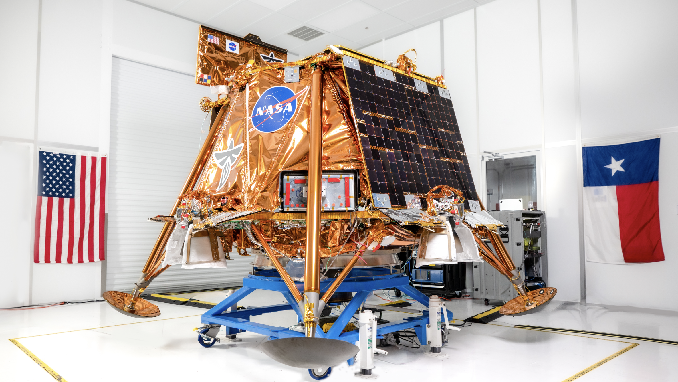
The LuGRE payload will launch on 15 January with Firefly Aerospace’s Blue Ghost lander. Blue Ghost, part of NASA’s Commercial Lunar Payload Services plan, will carry nine other scientific projects for efforts such as lunar drilling and lunar dust collection.
The Blue Ghost lander will be launched on a SpaceX Falcon 9 rocket, and land on the moon’s surface in March.
The LuGRE mission’s data will be available to all lunar missions across countries and agencies, according to NASA.